
9.13.09

Sam and I headed out from his house in Redlands at around 8AM.
Destination: SART!
(Santa Ana River Trail, for those of you not "in the know...")
We rolled in to Angelus Oaks and made our way down the fireroad that is Middle Control Road. We passed the waterfall, and passed the outlet from the upper SART trail (the one that comes from the post office). We pulled over, parked at the turnoff and geared up for what was to be an epic (albeit exhausting) 21.5 miles!
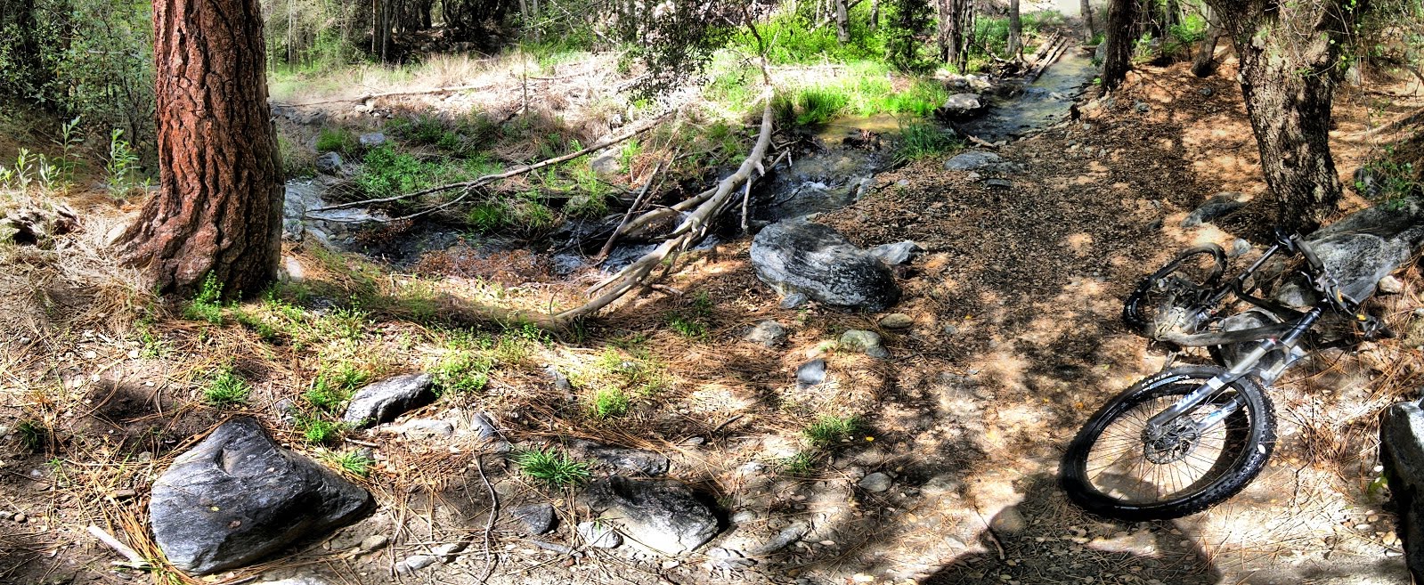
The ride up to Glass Mountain Road (the main paved road that intersects the SART) went well, with some good rolling sections and a fair amount of climbing. Only two or three downed trees in this 4.6 mile section. I kept up with Sam for the first while, but as soon as he grew tired of "biking with Miss Daisy", he kicked into high gear and probably felt like he was waiting for 3 hours by the time I made it to Glass Mountain Rd.

We stopped for a few minutes, (enough time for me to take the above panorama) and we crossed Glass Mountain Road (GMR) to head onto the 6 mile section (6 miles up, 6 miles back) up to South Fork Campground. Some more climbing, one HUGE downed tree, and about 12 hours more of waiting by Sam, and we found ourselves at the 3 or 4-way fork where you can choose to turn up to Barton Flats, continue to South Fork Campground, and I'm not sure where the other forks lead.
Here's a shot of some riders on the exposed section (traveling back toward GMR), just before the HUGE downed tree:
Here's a shot of some riders on the exposed section (traveling back toward GMR), just before the HUGE downed tree:


At the fork, we met two guys from Orange County who were dealing with a tire gouge and a flat. Sam proceeded to teach them about the "dollar fix", where you place a dollar bill between the inner tube and the tire gouge, to prevent the tube from squeezing through the tire gouge. We hypothesized that if a dollar bill worked good, then a 100-dollar bill would work even better! But alas, no one could produce one, so our theory will have to be affirmed another time. When I got home last night, I was browsing through the forums over at SoCalTrailRiders and found that one of the guys is Dylin, who goes by the name of "Pain" on the forums. Nice meeting you, Dylin, and your friend(sorry I didn't get your name, and I should have gotten a picture too!)
On we continued to South Fork Campground. I was still going "strong" (keep in mind, this is a very relative term, LOL) as long as I stopped for short breaks here and there. And there. And there, too. :)
"Feeling good" was my response to Sam's question about my stamina level at this point. Ahh, innocent ignorance. Sam was not so worried about the 6-7 miles that we had ridden, but more so about the fact that we were not yet at the half way point, as he has suffered through my mitochondrial deficit in rides past.
My odometer read 10.7 miles as we rolled into the campground.
10.7 miles. That meant that our ride was going to be 21 miles long. Although, if you asked me to do that same amount of mathematical calculation during mile 19, I would have had to take out my phone and use the calculator function, although it is up for debate as to whether I would have even comprehended your question in the first place. Prior to this, my longest ride was in Idyllwild/Hurkey Creek (12-13 miles), which usually leaves me collapsed on a park bench or on a grassy clearing while Sam rides up 5 miles to get the car, as buzzards begin to circle and small children from the campground gather to poke me with sticks in an attempt to stir the hibernating beast. It's kind of like a "1/2 shuttle", where I get shuttled, and Sam rides the full loop! LOL. (That's all true, except for the buzzard and stick-poking part.)
Keep in mind, my normal rides are 6-10 miles in length, and since I love to take pictures, I end up stopping for "picture breaks" every time I see a good shot! Someone forgot to teach Sam what breaks are, so my rides with him are a lot different!

Back to the ride: Just enough time to take the above picture, munch down a snack bar, and catch my breath, at which point Captain Sam said it was time to go! So we turned around and headed back to Middle Control Road.
Heading west from South Fork Campground, the last two miles or so before you reach GMR are pretty epic! Here's the video:
When I hit GMR, my odometer read just under 17 miles. By this time, I was BEAT. Still over 4 miles to go!
By mile 18, the delirium had set in at full force. Strength, morale, and love for mountain biking were approaching a nonexistent level. Any slight uphill grade promptly turned into a hike-a-bike section. The downhills became dangerous, as I could barely maneuver the bike around obstacles.
Don't try this at home, kids!
A log roll-over and a few stream crossings later, I found myself on the last mile or so of downhill back to Middle Control Road (MCT). The last corner was a welcome one, as my "rescue vehicle" came into view. As Sam helped me load my bike up on the rack, one last gaze at the odometer showed just about 21.5 miles, at which point I mustered the strength to remove my gear and collapse into the passenger seat.
We made our way back to Sam's house in Redlands, and I realized while the last few miles of the ride were pretty ridiculous, I was happy that I had survived my first ride into the 20-mile range!
From Sam's house, I loaded Big Red up onto the trusty Altima...
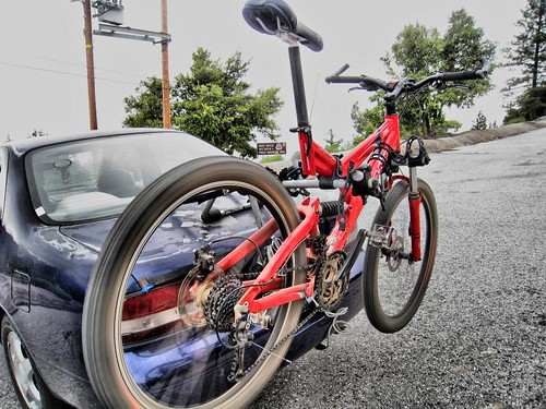
... and made my way back into San Bernardino.
I linked up with Sunny (my wife) and met my parents at Hometown Buffet (one of my dad's favorites) for a sweet post-ride buffet lunch!
Overall, a great ride and SART was great fun, as always. And since it didn't kill me, I guess that means I'm stronger now??

Here are a few more videos I took with the helmet cam.
santa ana river trail SART inland empire mountain biking angelus oaks south fork campground

No comments:
Post a Comment